‘Places to enter and exit the harbor safely in canoes, kayaks, rafts, sailboats, and rowboats, to educate by interacting with the water—or just to touch the water—remain strangely scarce for a city of over 8 million people.’

Courtesy of Rob Buchanan
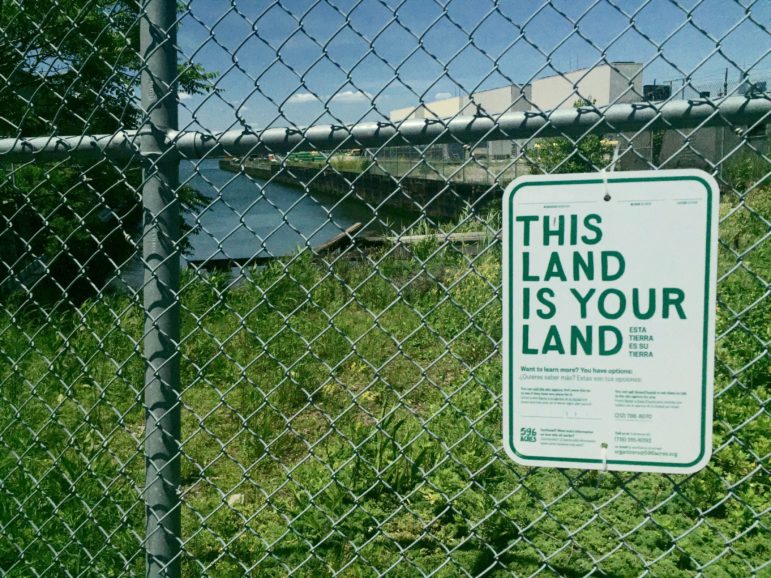
The street end of the 28th Street in Brooklyn’s Sunset Park, where advocates have been pushing for public access.Where can you get to the water? In a city with more than 500 miles of shoreline flung out across five boroughs, the water is all around us in New York City. But in many ways New Yorkers remain weirdly divorced from this shared “sixth borough”—we may be able to see the water in places, but we often cannot get right down to it. Places to enter and exit the harbor safely in canoes, kayaks, rafts, sailboats, and rowboats, to educate by interacting with the water—or just to touch the water—remain strangely scarce for a city of over 8 million people.
We can do better. We can give New York City the meaningful, equitable water access a world-class city deserves. All we have to do is look to the nearest street-end at the water’s edge.
These mundane but crucial public places have great potential to solve many existing access and safety issues, as well as improve resilience to climate change through land preservation. Transforming street-ends into landings, beaches, and small dock sites creates enlivened places that add to our quality of life and connect us to the environment in an urban setting. Waterfront places of lively linkage and transition—like Dyckman Street in Manhattan, the Penny Bridge site on Newtown Creek in Brooklyn, Second Street in Hunter’s Point, Queens, and Hunts Point Riverside Park in the Bronx—engage people.
One microcosm in Brooklyn shows what works, and what remains to be done. The dock at the foot of 2nd Street on the Gowanus Canal is a testament to what street-ends can do for water access. But while this site has flourished with shoreline activity, street-ends serving less affluent neighborhoods down the waterway at Huntington Street and at 28th Street in Sunset Park remain fenced, rendering the water inaccessible. A Vernon Boulevard street-end in Queens, too, is in danger of being walled off despite community plans for access to the water.
Crucially, every New Yorker can help convince the city to make 2021 a watershed year for increased waterfront access at our vast collection of overlooked street-ends. In a few months, the Department of City Planning will be finalizing the latest Comprehensive Waterfront Plan, a document generated once every 10 years that lays out a vision for the city’s next decade along the waterfront. After many meetings and sessions, we sense City Planning is cognizant of the potential for climate change resilience projects at street-ends and the need to emphasize equitable waterfront access.
But it’s critical, if the ideals of access are to be made real in the next decade, for the Waterfront Plan to embrace a practical, widespread means of facilitating this desired access in the real world. The new Waterfront Plan must include a clarion call to transform our many street-ends at the water’s edge into a citywide nexus of real portals to our shared waterways. These improved public spaces at the water’s edge, especially given improving water conditions, could facilitate additional benefits: places to facilitate rescues, locations for hands-on education and water quality testing, spots for fishing, sites for landing sail freight cargo, and even small-scale transit.
What will our waterfront look like in 2030? Where will you be able to get to—and out onto—the water? Where will fellow New Yorkers in neighborhoods not quite as fortunate as yours go to do the same? In part, it’s up to you.We encourage everyone to contact City Planning and agencies, like the Department of Transportation, that oversee street-ends in your neighborhood (don’t forget your elected officials, too). Demand that the Waterfront Plan focus on providing beaches, landings, and docks alongside climate change resilience features at waterfront street-ends across the city: waterfrontplan@planning.nyc.gov.
Cortney Koenig Worrall is president and CEO of the Waterfront Alliance. Rob Buchanan is co-founder of the NYC Water Trail Association. Brad Vogel is captain of the Gowanus Dredgers Canoe Club. Luis López is a board member of the Inwood Canoe Club. Jacky Krogh is a member of Kayak Staten Island. Other organizations that have signed on to support the call for access to waterfront street-ends include: Tideland Institute, Rocking the Boat, Sunset Spark, Schooner Apollonia, Newtown Creek Alliance, New York Open Water, Red Hook Boaters, NYC Poets Afloat, North Brooklyn Community Boathouse and the Billion Oyster Project.


One thought on “Opinion: Let’s Transform NYC’s Waterfront Street-Ends for Equitable Water Access”
It would be really nifty if the Waterfront Alliance would advocate for more dock space in general, for all types of vessels, instead of just human powered access.
There are almost no usable docks anywhere anymore. Likely later this year over 1,000 feet of space in Brooklyn will be given to NYC Ferry for a duplicate storage and maintenance facility. This will force upwards of 10 vessels of various types to find new berths. It will go from a revenue generating site to an expensive home for incredibly subsidized ferries.
Cities like Boston and Baltimore have very accessible and active waterfronts, for all types of craft. They have plenty of locations for visiting historic ships, an event that hasn’t happened in New York in years.
Waterfront Alliance should look to places like those as an example for how to actually advocate for better things in New York. It’s really sad that we live in a place where the maritime history and use used to be second to none and responsibly directly for the growth of much of this country and now access to boats or the waterfront is almost completely non existent. End Roland’s legacy of supporting the highest donor and start focusing on what and how the waterfront could benefit all.